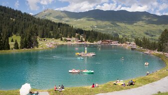
Untere and Obere Glockhäuser (2.600 m) from Lazid
Starting point: Lazid top station
Character: medium difficult mountain tour in alpine terrain, with beautiful lakes
Walking time: 4 hours
Description: From the Lazidbahn top station (S301) on the vehicle track to the Scheid (S217). Behind the cable car station (S218) onto the Murmeltiersteig trail no. 25a, hike over the Kitzköpfl to the Furglersee
lake (S211). Just behind the lake (S209) veer off in a northwesterly direction via the Kanzel (trail no. 24) to the Obere Glockhäuser (S263).


