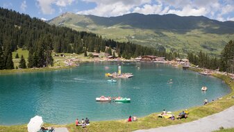
Brunnenkopfsteig trail (Vorderer Brunnenkopf – 2,685 m)
Starting point: Komperdellbahn top station
Character: mountain tour on a steep trail
Walking time: 2½ hours
Description: Go on the Quellensteig (Source Trail) no. 20 to the crossing (S243). Turn left and head upwards on trail no. 20a to the Fisser Waal (S244, ruins of a water moat). The trail continues in many serpentines, past a wrought iron crucifix to the Vorderer Brunnenkopf (S255).


