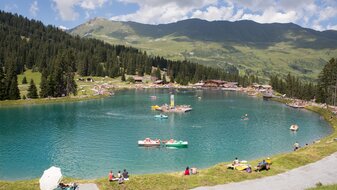
Furgler (3,004 m) starting from Komperdell
Starting point: Komperdellbahn top station
Character: Mountain tour on narrow trail with easy climbing sections
Walking time: 4 hours
Description:From the Komperdellbahn top station (S201) short and steep ascent northwestwards then gradually ascending in a westerly direction. Identical with Weitwanderweg trail 702 to the Furglersee lake (S211). From the Furglersee lake you ascend westwards through the usually snowy Furglertal valley between the Furgler (left) and Kleiner Furgler (right) over scree to the Furglerjoch (2,748 m, S212). From here, go over the north ridge (sometimes leaving the ridge) in an easy bit of climbing to the summit (S213).


