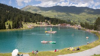
Furglersee lake (2.459 m) starting from Komperdell - Murmeltiersteig trail
Starting point: Komperdelltop station
Character: superb trail into the region typical for marmottes
Walking time: 3½ hours
Description:From the Komperdellbahn mountain station (S201) short and steep ascent northwestwards then gradually ascending in a westerly direction. Identical with Weitwanderweg trail 702. From the Furglersee lake (S211) via the Murmeltiersteig 25a to the Lazid (Lazidbahn top station).


